Yeah I checked out that site. They got a lot of nice ones. I liked this one but i really dont know what to get in a gps unit as far as all the different abilities. I am doing research trying to get a decent one.Originally Posted by nfpgasmask


 Super VXer
Yeah I checked out that site. They got a lot of nice ones. I liked this one but i really dont know what to get in a gps unit as far as all the different abilities. I am doing research trying to get a decent one.
 Super VXer
For GPS, I'd recommend a Garmin (or Magellan, though I don't have too much experience with Magellans) - I think they have the most complete maps in general.
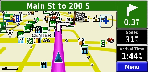
Mine is a Street Pilot 7200 - a full blown monster with all the bells and whistles and I love it. Though not too feasible in the VX, unless you mount it in your dash.
I bought a Garmin 550 for my Dad it was about one third the cost (~$400) of the Street Pilot 7200 and I could tell the difference right away in options beyond screen size and memory.
The new Garmins have a much brighter screen - nice.
Only the mid to higher end Garmins now have text to speech to name the actual roads (a very nice option that I would miss).
The mid to smaller ones have batteries so they are portable.
The newer Garmins have a better internal antenna to get better reception around tall buildings downtown and cloud cover etc....
I also found the Street Pilots to be very easy and more intuitive when passing through menus to search destinations and set options, as well as select icons on the screen for more info.
In all, I wouldn't skimp on one and get the most options you can related to GPS. (Some have mp3 options that I think are useless to most) I'd consider going the extra cash to get some worthwhile options like bigger internal memory for full maps, personal Points Of Interest programming (for plugging in speed trap zones), etc...
Just my two cents.
[EDIT: Sorry, I just took a look at what type of GPS you are looking at, and what I'm talking about. You're looking at more into handhelds, I'm going off on a car GPS for driving, oops. Hope some of the info is useful....]
Good Luck
Last edited by Kenny : 06/22/2007 at 06:42 AM
Super VXer
I have the Garmin Vista (25 gig), Rhino 120 (8 gig), and the Rhino 110 (1 gig). I use the MapSource United States Topo. I comes with three CDs (Eastern U.S., Western U.S., Alaska and Hawaii). If I'm not mistaking, it was about $100 at REI.
When I went to Moab this year I mounted my Rhino 120 on the blank button near the cruise control. I was able to download all the maps from Northern New Mexico to Moab, Utah.
It worked out really well.
Peace.
Tom
"Through Great Sacrifice..... Great Rewards Will Be Achieved"
Super VXer
Thanks Kenny, any info is helpful at this point. I am looking at the handhelds just because I may want to hike if I go camping and it would be nice to take along.
Thanks Tom, did that Mapsource have backroads type stuff as well?
 Super VXer
Yes, the Mapsource software does have trails, etc. The one I had with me when we went to the Flats was the Garmin Etrex Vista, and I think I had the Topo maps loaded, iirc. Its pretty good for trails and such, but sometimes it seems that maybe there are newer trails that aren't on the maps yet. And you definitely can't tell from the GPS if you are headed down a trail that has been washed out like the one we ran into.
The thing to think about with the Garmins is that they use proprietary software (that being MapSource) and no other software will work with a Garmin (as far as I know).
I chose the Etrex Vista CX because it was the best handheld they made at the time, might still be. Its got a very clear color screen, and its pretty easy to use. Also, it has a compass on it that does not require you to be moving to work (I guess some of the lesser models require you to me moving to get a compass reading). I like it because it has altitude readings on it too, so I can always tell how high up I am. It also stores your "record" altitude. Mine right now is about 11,500 feet or something like that.
Currently, I am on the hunt for some good Map software that will work with my Garmin that I can use in Japan....I'm not having much luck though
Bart
Super VXer
I know that national geographic one will let you plug in way points to your garmin, but no maps themselves. When are you going to Japan? That would be sweet.
Super VXer
No plans yet. But me and wife have been wanting to go for a long time. So, we got to thinking, how sweet would it be if you could get a really nice street map set for Tokyo, Kyoto and Osaka and map out all your way points ahead of time? This way, getting around there would sooooo much easier.
We were thinking sometime next year, depending on if we buy a house or not. The Reno housing market really chaps my arse...
Bart
 Super VXer
Only two things you need to get around Japan are a bike and a train pass! Been there twice and don't look forward to going again. Crowded, crowded , and oh, did I mention it was crowded. But it was cool to see once. A totally different culture from what we are used to here.
Billy Oliver
15xIronman
My Sponsors:
Accelerate3Coaching
TriSports.com (PM me for 1 time use 20% off code)
Super VXer
Well, I'm not so much worried about getting around, as much as I am worried about finding the places I want to find. Both the wife and I are way into Japanese Otoku subculture, and there are all sorts of shops and stuff I know we will want to find, and I have read that a lot of the stores are tough to locate since they might be on the 11th floor of some building that is all marked in Kanjii and I can't read a lick so....the GPS idea would be sweet, if I could find a map of Tokyo with streets and stuff in English and Japanese...
Bart
PS - We are not THIS nerdy though...
 Posting Permissions


 Reply With Quote